
FakeGeo
Create rich, realistic geospatial data for showcasing, developing, and testing map applications.

Easy to Use API
Get started with simple API calls to generate realistic geospatial data in seconds. Focus on showcasing your map designs without the hassle of stubbing or manual GeoJSON creation. Effortlessly test, develop, and iterate with our reliable and ready-to-use endpoints!
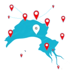
Flexible
Tailor your geospatial data needs with ease. Generate as much or as little as required. Specify any area to get data from and control them via simple API calls. Optionally include random properties for map popup visualization or stick to pure geometries.

Customizable Outputs
Fine-tune your geospatial data to match your project needs. Choose from a variety of geometry types such as points, lines, or polygons features or feature collections to fit your use case.